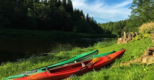
Winding on the steep bank of the Dubysa valley, the Forest Trail crosses a small forest for 2.5 km and further 4 km up to Čekiškė through an area where large corn fields bloom in summer. A similar landscape can be seen for the next 9 km, until the Forest Trail crosses the Kaunas–Klaipėda highway (A1) along the bridge. About 1.5 km further, before Gėluva village, the Forest Trail descends into the deep Dubysa valley and winds along small paths and quiet country roads along the bends of the river, revealing wide views of the town of Ariogala at the top of the valley. Along Dubysos and Gedimino streets, it winds up to the town's central street, Vytauto street. Further along Plento street, the Forest Trail 5 km from the centre reaches the point where you have to turn to the end of the section – Krikšnovė pond (another 0.2 km).
Practical information
Length: 27 km
Duration: 7 – 9 h
Starting point: Padubysys village by “Zalensų sodyba” (tourist accommodation)
End point: Krikšnovė pond
The course of the route: Padubysys – Čekiškė – Ariogala – Krikšnovė pond
Road surface: Asphalt, in Dubysa valley – small trails and dirt roads.
Difficulty: Hard
Danger points: Be careful when walking along the side of the road!
Good to know! It is worth buying food supplies for the next two days in Ariogala.
Alternatives: This step must be done in one day, as there is no accommodation in and around Ariogala. If this is not possible in one day, you can use the bus from Ariogala or contact the hosts of accommodation to arrange a transfer from a specific location on the route.
Nature
The source of the Dubysa river is located near Šiauliai. The river crosses the Žemaitija Upland, flowing into the Nemunas near Seredžius village. The water level in Dubysa varies greatly and is influenced by both melting snow and rainwater collected by the rivers and streams of the Žemaitija Upland. It is not for nothing that this river is very popular with water tourists. In summer it has a calm flow, the river is clear, the bottom is sandy in most places, which makes Dubysa very suitable for peaceful swimming. The Dubysa river valley is one of the deepest (20–40 m) and widest (up to 0.5 km) in Lithuania, formed by a glacier. During the Russian Empire in 1825, a project was launched to connect Dubysa with Venta via the so-called Venta–Dubysa Canal or Vindava Canal. The work was carried out by 18,000 soldiers and 3,000 civilians. The purpose of the canal was to connect the Nemunas basin with the Baltic Sea and the port of Ventspils, because the lower reaches of the Nemunas were under Prussian control at that time. These works were disrupted by various historical events, including the First World War, after which the canal lost its significance as Lithuania acquired land in the lower reaches of the Nemunas. Back in the 1970s, the canal was used for rowing competitions, but today it is abandoned and overgrown, although it is declared a cultural monument.
Tourism information:
- Kaunas district Tourism and Business Information Center
Address: Pilies takas 1, Raudondvaris, Kaunas district; Phone: +370 37548118; Website: www.kaunorajonas.lt
- Public Institution “Atrask Rasenius”
Address: Vytauto Didžiojo street 17, Raseiniai; Phone: +370 61834611; Website: http://en.atraskraseinius.lt/
More information about the route (accommodation, catering, shops, map, GPX coordinates) - https://baltictrails.eu/en/forest/day/145


